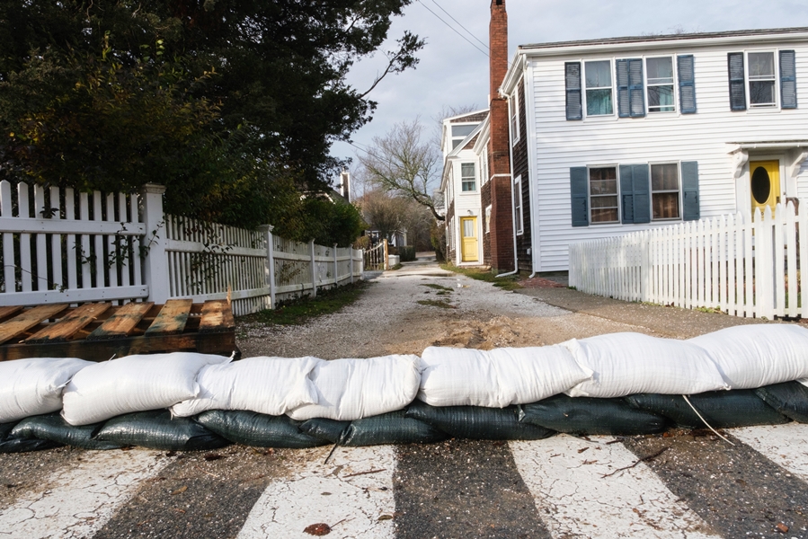
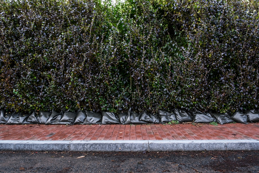
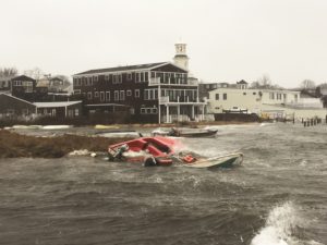
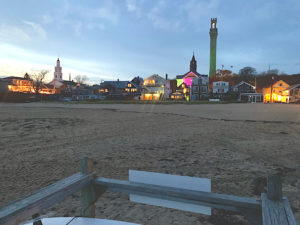
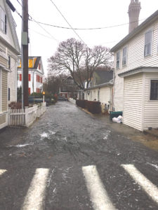
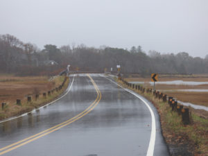
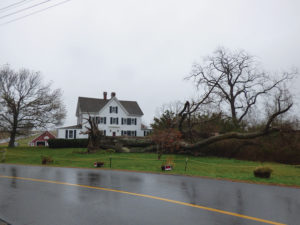
WELLFLEET — For at least eight days this month, the roads connecting Bound Brook Island to the rest of town have been inundated with floodwater that prevented people from accessing the island.
flooding
HIGH HIGH
Eastham Bylaw Linking House Size to Uplands Isn’t Clear
What’s safe from flooding at high tides? It depends.
EASTHAM — Town meeting voters approved a bylaw change last spring that linked the allowed size of a proposed house to the size of contiguous uplands on the property rather than to its overall square footage. The purpose of the change was to preserve the character of Eastham by prohibiting massive homes on small lots.
Site plan review for a proposal to merge two coastal lots and demolish the existing houses on them to make room for a new 5,317-square-foot house overlooking Cape Cod Bay put the new bylaw to the test at a planning board hearing on Dec. 20.
The two properties are at 15 Sunset Lane and 40 Bay Shore Lane; both are owned by Craig and Lynne Perry, who live in Southbury, Conn.
The term “uplands” is broadly defined in the bylaw as land that excludes all wetlands, land under a water body, fresh or saltwater marsh, and areas subject to flooding at high tides. But the debate at the hearing revealed confusion over that last point: how to calculate the spot where high tide ends and dry land begins.
In fact, for most of the discussion the town’s community development coordinator, Philip Burt, and Bradford Malo, the Coastal Engineering Company’s project manager, who was there representing the Perrys, appeared to be the only people in the room who could follow it.
There are a handful of ways to determine the mean high-water line, from an unscientific “eyeball approach” to standardized methods developed by government agencies like the Dept. of Environmental Protection, the Army Corps of Engineers, and the National Oceanic and Atmospheric Administration.
Engineers generally base the location of the mean high-water line on an average of the tides over 19 years, according to Malo. Using that method, Malo had calculated the uplands area of the lot at 51,244 square feet, which put the proposed 5,317-square-foot house well within the allowed range. Any property with more than 50,000 square feet of uplands can support a house up to 6,000 square feet under the new bylaw.
Planning board chair Dan Coppelman asked Town Planner Paul Lagg how that uplands calculation matched up with the town’s bylaw.
That’s when the conversation became complicated.
Lagg said the new bylaw isn’t specific enough to tell. “It just says what is subject to flooding from high tides” can’t be counted as uplands, he said.
The aim of the bylaw is to link the size of a proposed house to the square footage of uplands on a property. But that’s not being achieved, Lagg said, “if I go out there and it’s under water.”
Burt said he went to the area in front of the Perrys’ lots during an astronomical high tide and saw water come up nearly to the base of the dune. Doing an on-the-spot rough calculation, Coppelman said that moving the high-tide line up to the edge of the dune would shrink the uplands calculation to 44,000 square feet.
Using that figure, the size of the house would have to be reduced. The house size can’t exceed 11 percent of the uplands total.
When Malo argued there were other regulatory definitions used by agencies like DEP, Coppelman replied, “It’s not your definition or anybody else’s definition; it’s the town of Eastham’s definition.”
Burt said NOAA’s calculation method for coastal Eastham is based on data from two points: Sesuit Harbor in Dennis and Provincetown Harbor. There is a way to calculate the mean high-water line and the mean “high high-water line” based on those points, he said.
The mean high is a line that the tide will go past about 50 percent of the time and fall below 50 percent of the time, Burt said. The “mean high high” is an average of the higher tides in the daily two-high-tide cycle.
“The contour line is about one foot west of the dune base, so we have to determine how much area that is,” Burt said.
Malo countered that he had already calculated the mean high high-tide line, basing it on a survey of the property. That line, he said, resulted in an uplands calculation of 50,810 square feet. By that method, the proposed size of the house would still be within the town’s standards.
The board gave the project site plan approval with some conditions. One of those was submitting a plan showing the mean high high-water line that would satisfy Lagg and Burt, since they are the board’s experts on the matter.
In a phone interview last week, Burt said he reviewed the plan with Malo following the Dec. 20 meeting. “Ultimately,” he said, “we go on their engineered plans.”
Both Burt and Lagg told the Independent they believe the town must tighten the wording regarding tide lines in the new bylaw to avoid debates like this one in the future.
Since the proposal calls for demolition of two existing houses, one of which is a bungalow built in 1948, a review will be required by the Eastham Historical Commission to determine whether the house is historically significant. If the commission decides that it would be preferable to preserve the house, it could delay demolition for up to 12 months under the town’s demolition delay bylaw.
TOWN MEETING PREVIEW
Voters to Be Asked for $3.5M to Fix Court Street Flooding
The town budget is up 8.2 percent; schools ask 18 percent more
PROVINCETOWN — Dept. of Public Works Director Rich Waldo said it is possible to fix the flooding that has for decades impeded pedestrians, harmed businesses, and damaged cars at the corner of Court Street and Shank Painter Road.
But it’s going to cost $3.5 million, an expense on the warrant for the May 1 annual town meeting. That is the largest of five budget override requests on the 39-article warrant. It must pass by a two-thirds majority at the meeting and by a majority vote at the May 11 town election.
The $3.5-million debt exclusion would increase taxes on a home valued at $620,500 by $55.85 in the first year, according to Finance Director Josee Young.
Court Street floods because of wetlands being filled decades ago, though exactly what happened remains the subject of rumors, Waldo said. The area is a perfect storm of poor drainage. The flat topography is low-lying, with groundwater just below the surface, near a wetland, and in a 30-acre watershed, Waldo said.
The giant puddles that last for days in front of Cape Cod Excavating, Cape Tip Seafoods, and BWell Holdings (formerly Fay’s Automotive) will require large pumps and pipes to move that water far enough away.
The proposed pumping station will take water from Court Street to the north end of Shank Painter Road, where it will go into a retention area at a proposed roundabout at the intersection with Route 6. The good news, Waldo said, is that the roundabout and water retention area will be paid for by the state as part of the $14-million reconstruction of Shank Painter Road.
The Shank Painter project is now fully funded and expected to go out to bid in 2023, Waldo said.
The retention area on Route 6 would direct overflow into Duck Pond following huge rainstorms, Waldo said. Duck Pond, north of Route 6, “is a very large wetland, so there would be no impact,” he said. “You will not notice the added water.”
The flooding has “plagued the town for a long time,” Waldo added, “and if the town is serious about getting rid of that problem, this is the way to do it.”
This fix would be game-changing for residents and business owners on Court Street. In 2017, Rita Silva, of 40 Court St., told the Provincetown Banner, “My husband is handicapped. He only has one leg and sometimes the water is so bad I can’t get him down our ramp. I have to push him through the water.”
Since then, the town’s DPW has started to pump as soon as there is a big rain, and “that has saved us,” Silva told the Independent this week.
Other Big Tickets
The town’s operating budget for fiscal 2022 is up 8.2 percent overall, though the size of the increase is deceiving because town staff kept the 2021 budget low, due to concerns about revenue shortfalls from the pandemic, Young said. The town’s $30.7-million budget is up by $2.3 million from the current year. But it’s only a $1.09-million or 3.7-percent increase over 2020, due mostly to fixed costs, she said.
The school budget of $5,126,441, however, is up 18.4 percent. Several factors are in play. First, the early learning center, which offers free child care and preschool for infants up to kindergarten is extremely popular and growing annually, said School Supt. Suzanne Scallion. Its costs are up by 17.5 percent to $581,657.
“We need to have our eyes wide open on how the early learning center has affected the school budget,” Scallion told the finance committee and select board in January.
Scallion and Mark Hatch, chair of the finance committee, have each said it’s time to talk about charging fees on a sliding scale so parents who can afford to pay help support the program.
The school budget increase is also due to the rehiring of a business manager, a job that had been done by the superintendent’s assistant for one year. But that proved unmanageable, said the superintendent. Scallion, who is not paid insurance benefits and works part-time, also saw a salary increase from $64,000 in 2021 to $82,000 in 2022.
Noting that the average full-time superintendent earned $140,000, school committee chair Eva Enos said, “I have no doubt she deserves every single penny. … The school committee is united in having trust in Suzanne.”
Lastly, the school committee is trying to protect money earned from school choice, that is, the tuition paid for out-of-district students. The former superintendent, Beth Singer, used school choice funds to offset expenses generally, Hatch told the Independent.
Scallion is preserving school choice for direct education enrichment costs, such as paying for music and theater staff, she said.
Last year, when all department heads had to tighten budgets, the school dept. used school choice funds to cover basic operating expenses. But that’s not their purpose, Enos said. This year, even though the school choice fund now has $566,000 in it, the department plans to use only $288,481 towards its budget and save the rest for unforeseen future costs.
Other Debt Exclusions
Other debt exclusion requests on the town meeting warrant include Article 10R, $410,000 for storm water improvements, with a first-year tax impact on a $620,500 home of $8.03; Article 10S, $530,000 for town building repairs, with a tax impact of $10.35; and Article 10U, $625,000 for a storm water or outfall program at Ryder Street, with a tax impact of $13.44.
RISING WATERS
Before the Deluge: Plans for Commercial Street
‘Creative adaptation’ to flooding and insurance
PROVINCETOWN — Floodwaters are a primal force, invading the landscape, insisting that things must change. In the January 2018 flood, for example, seawater coursed down Gosnold Street and filled a large basin on Bradford Street to a depth of three feet. Scores of homes and other buildings were damaged, including town hall.
Flood insurance does its work more quietly, but it also forces change. The compounding of costs makes inaction too expensive to contemplate. The slow work of spreadsheets enables adaptations that we would otherwise choose to avoid.
There are a variety of changes currently taking place in federal flood insurance rules, and the Independent asked Barnstable County’s floodplain manager, Shannon Hulst, what they might mean for Provincetown.
In the historic district, where hundreds of properties abut the harbor, flood insurance costs are likely to escalate. The good news, according to Hulst, is that the rate of escalation is capped — 18 percent per year for primary residences, and 25 percent per year for commercial property and second homes. The owners of property with federal flood insurance can calculate future costs by compounding what they currently pay by those maximum rates of increase.
“This new rating system FEMA is working on, Risk Rating 2.0 — it’s supposed to figure out what you should be paying,” said Hulst. “Over time, your premium will rise to that new number, [but] it’s not going to change the rate at which your current premium can increase to that new ‘correct’ premium.”
The revised ratings are meant to distribute costs more fairly. Premiums for people who are in the floodplain but not directly on the water might go down, said Hulst. Insurance costs for people directly on the water are likely to go up. But the rate-of-change rules remain in place.
The Independent also asked about the floodplain bylaw changes that are on all four Outer Cape town meeting warrants.
“There’s a statewide model bylaw that pretty much every town in the state is adopting,” said Hulst. “As a legal matter, the state decided that towns can’t have a stricter building code than the state does. Everything that people are used to seeing in their local codes is in the state building code. So, all those strike-throughs from the town bylaws — all of that is found in the state code.”
That means the rules for when a home must be elevated to above base flood elevation still exist. If a residential property undergoes substantial improvements — defined as at least 50 percent of the value of the structure — or if it is substantially damaged, then it must be elevated.
Much of Commercial Street is mixed-use, with residential space on the upper floors and commercial on the ground floor. In these cases, different kinds of wet and dry floodproofing can sometimes be used, said Hulst.
Sarah Korjeff of the Cape Cod Commission is a historic preservation specialist working with Hulst and others on design standards for raising and floodproofing historic buildings. She’s focusing on Provincetown because of the unusual concentration of historic buildings located directly on the waterfront.
“In some cases, in order to preserve historic buildings, we will have to elevate them,” said Korjeff. “In other cases, there may be alternate ways of protecting them. You can have nonresidential uses in the flood zone and just do floodproofing, as long as the floors above with people in them would still be protected.” A nonresidential ground floor can be armored against floodwaters or designed to be permeable.
“That may not be an answer that will work for a very long time,” Korjeff cautioned. There are a lot of factors to consider, including building materials, depth of expected flooding, and potential wave energy.
“For example, Outer Cape Health’s building in Harwich Port — they were able to floodproof the bottom four feet of the structure, and then have these special inserts that they can place in the exterior doors,” said Korjeff. “If flooding gets up to the highest level that’s predicted, it still doesn’t necessarily get into the building.”
There are also landscape-level interventions, like the large dune that Provincetown is building at the beach between Gosnold and Ryder streets to block seawater from cascading down Gosnold again. Home owners might also build barriers around their property, or even around groups of houses in a flood-prone neighborhood, said Korjeff.
A group of six graduate students from Tufts University will be exploring more theoretical adaptations for Provincetown this spring. Town Planner Thaddeus Soule pitched Provincetown as an ideal place for students of urban and environmental planning to do such a project. At present, they’re asking Provincetown residents to fill out a survey (at forms.gle/X3LirefbmHpLQgi68) about their favorite historic buildings.
Later this spring, the students will be presenting their work to the select board. Soule encouraged them to dream big and imagine things such as engineered coastal defenses and floodable park spaces, as well as strategies to raise large numbers of buildings without destroying the human-scale streetscapes of Provincetown.
In the summer, the local comprehensive plan committee should be presenting drafts of a new LCP. Because the goals identified in the plan set the criteria for judging applications that come before other committees, it is effectively the master policy document that will guide future development.
“We can’t have standards weaker than the Massachusetts building code,” Soule said. “But could we be more proactive, and do more, sooner? It would be great if we came up with a holistic plan that balanced community needs with the rights of individual property owners.”
To keep Commercial Street appealing to pedestrians, for example, the town might decide it wants café tables or pop-up shopping under lifted historic buildings, instead of parking lots and dumpsters. Once a policy is chosen, the town can nudge proposals to look more like the LCP.
Envisioning a flood-safe, enjoyable streetscape and making a plan to get there is a “this year” project — something to do before the next big flood, instead of after.
ENVIRONMENT
Truro Takes a Shot at Restoring Tidal Flow to the Pamet
Officials prepare for emergency fix of a failed culvert
TRURO — George Mooney couldn’t recognize his farm on South Pamet Road. His pasture and vegetable gardens were completely submerged under two feet of salt water during three consecutive nor’easters in March 2018.
Instead of draining out of the river with the outgoing tide, the ocean water that had poured over the Ballston Beach dunes at the valley’s eastern edge stayed on the Mooney farm, and in the entire valley of the Pamet, for two weeks.
The only way out for the salt water was to the west, through a narrow, damaged culvert under Truro Center Road — a culvert built in 1869 to block the flow of salt water from the Pamet Marsh and keep the water of the Upper Pamet fresh.
After that 2018 flood, Mooney couldn’t plant anything for two years. The river water lost its clarity. Invasive phragmites returned and trees began to die. Frogs and turtles disappeared.
“All of my land, even on the other side of the road, was completely submerged for two weeks after those storms,” Mooney said. “It just sat there and killed everything.”
Storm surges that breach Ballston Beach have become a regular event, causing flooding, stagnation, damage, and death.
But in a few years, that could change. The town of Truro is currently in the early stages of a daunting task: restoring the tidal flow to the Upper Pamet River and returning the river to its natural saltwater state.
“We have made a commitment to do the restoration of the Pamet,” said Truro Conservation Agent Emily Beebe.
Restoration Partners
Truro has partnered since March with the U.S. Dept. of Agriculture, Cape Cod Conservation District, and the Woods Hole Group to review all of the scientific data collected on the Upper Pamet by the Army Corps of Engineers, Cape Cod National Seashore, Center for Coastal Studies, and others, since the 1980s. Once their final report is complete — expected in December or January — the town will offer a plan for a new culvert under Truro Center Road.
Then begins a long process of permitting through multiple regulatory agencies, funding, and bidding out to potential contractors. According to DPW Director Jarrod Cabral, the best-case timeline is at least two years.
That is, if the culvert doesn’t fail first.
The fiercest nor’easters usually come between September and April. A March 2020 letter from the Woods Hole Group warned of damage that may occur in the next major storm.
“The town is concerned that this archaic, poorly built culvert structure will fail during the next large storm,” the letter said, “causing severe upstream flooding and either severely damaging or destroying [Truro Center Road].”
Truro has been unable to make headway on the problem while awaiting results of an Army Corps study commissioned in 2016 to analyze the effects of restored tidal flow to the river and private properties along it, said Beebe.
Now the Army Corps report is done, but the scientific review and at least two years of regulatory obstacles remain. So, Truro is preparing itself for an emergency fix in case of a damaging storm.
“If [the culvert] fails before the planning is done, then ideally we have enough information to put something in there that doesn’t have to be temporary,” Beebe said.
Paying for Past Mistakes
Fixing the mistakes of the past has proved to be a challenge.
“Things were done that we are paying the price for now, because the consequences of those projects really weren’t understood until now,” Beebe said. “A tidally restricted water body is an unhealthy water body, period.”
When the Upper Pamet River was initially diked in 1869, the problems were not immediately clear. Private homes in the valley enjoyed access to fresh water. But when a massive storm surge on Oct. 31, 1991, broke through the Ballston dunes and flooded the river, residents and officials realized the culvert could not handle large floods. The freshwater environment would also not survive increasingly frequent saltwater intrusions.
During the early ’90s, local, state, and federal officials pushed for a study to analyze the potential impacts of renewed tidal flow, including possible saltwater intrusion in groundwater and private wells and septic systems.
Then, in 1998, the Army Corps concluded the groundwater would not be significantly affected. Still, the project of returning the river to its natural state did not lift off.
This has been true for other Cape Cod saltwater estuaries as well. Over time, the number of stakeholders grows and governmental regulations pile up. So, the project remains on the shelf. Even if everything runs smoothly, restoration projects can take decades.
The Herring River Restoration Project, for example, was first conceived around 1989. Thirty years later, it is still in the final stages of planning.
“It is a really complicated project involving numerous federal, state, and regulatory agencies, and, quite frankly, it’s a real burden on a small town staff,” said former Truro Selectman Jay Coburn.
Mitigating Flood Risk
Scientists have spent the past two decades analyzing water levels, stream flow rates, groundwater systems, wells, and salinity levels to determine the effects of a return of salt water in the Pamet Valley.
“The information that has been gathered seems to be consistent — that the geology protects the freshwater lens in that area,” Beebe said.
There is also consensus that returning the Upper Pamet to its natural state will mitigate flood risks for Truro’s town center and the private properties in the valley. With less restrictive culverts and free flowing water, an overwash will be able to naturally drain out with the tides. And, according to John Portnoy, a retired National Seashore ecologist recognized for his work on the Herring River Project, an overwash will return to being a natural and important process.
“When you drain salt-marsh peat, it shrinks like a drying-out sponge,” explained Portnoy. “If tidal flow is restored, these overwashes will be healthy, because they will bring in huge swaths of sandy sediments that spread across the marsh surface with the tides, bringing the marsh levels closer to equilibrium with mean sea levels and mitigating flood risks.”
Now, under the leadership of Beebe and Cabral, Truro may have its best shot at restoring the Upper Pamet River and many other waterways, including Eagle Creek, East Harbor, Mill Pond, and the Little Pamet River — all currently in the works. All but East Harbor are backwaters connected to the Pamet Marsh that have suffered significant ecological damage from restricted flow.
“Prior to 2016, I can say with confidence all of those projects were kind of sitting on a shelf,” Cabral said. “We have to pick up the ball and start running as fast as we can.”
For the Upper Pamet River, complete restoration is a distant goal. Even after replacement of the town-owned culvert under Truro Center Road, the town will have to get the state Dept. of Transportation to fix the culvert that runs under Route 6, which also considerably restricts water flow.
Still, the commitment to restore the river is a major step for an environmental project that has failed to lift off for decades.
Editor’s note: An earlier version of this article erroneously identified one of the partners in the Pamet research as the Woods Hole Oceanographic Institution. In fact, it is the Woods Hole Group, an engineering firm.
RISING WATERS
Buildings Are Raised Against Future Floods
But for now, only a few will be lifted
PROVINCETOWN — The Old Reliable Fish House property at 227R Commercial St. may be getting rebuilt on piers, and in the applications there’s an eye-popping number for their height: 17 feet. There’s a house near St. Mary of the Harbor in the East End that now stands nine feet off the ground, and Delft Haven in the West End has approvals to go up three feet.
CLIMATE
Another Winter Without a Dune Protecting Gosnold St.
Shifting sands and legal tangles lead to temporary measures
PROVINCETOWN — The Jan. 4, 2018, nor’easter brought a storm surge with it that seemed to lift water out of Provincetown harbor and pour it down Gosnold Street like a river.
Salt water rose up over the beach and flowed along Gosnold to Bradford Street, where it formed a deep pool around the Bas Relief that flooded scores of homes and businesses. Since then, the town has been working on a dune installation project for a small stretch of beach that would protect the center of town from seawater. The project will need another year to be completed, however, so the smaller, temporary berm that the dept. of public works installed last winter should return this season.
Provincetown’s conservation agent, Tim Famulare, has been heading up the effort to get the dune built, and he updated the Independent on the project’s status.
“Last time we talked, we were looking for nine signatures from nine underlying property owners,” Famulare said. “It’s gotten more interesting since then.”
Shifting sands have made property rights somewhat unclear, Famulare said. The beach has grown dramatically since property lines were drawn in the 1800s, and the historical mean high-water line actually runs through the back of several current buildings. The current mean high-water line is about 40 yards out, because of all the beach that has accumulated since the property lines were drawn. There are competing or overlapping claims to that accumulated beach.
“Current property owners have rights all the way out to the current mean high-water line,” said Famulare. “In most of Massachusetts, property owners actually have some rights all the way out to the current mean low-water line, meaning all of the flats that are exposed at low tide. Provincetown is different, though. Because we were the Province Lands, and all the land west of Howland Street was at one point held in common for the whole commonwealth, that means all of the intertidal flats west of Howland Street are what’s called ‘commonwealth tide lands.’
“There aren’t a lot of commonwealth tide lands in the state,” Famulare went on. “The town has lots of privileges on commonwealth tide lands, and those are defined by the historic mean high-water line, not the current one. That means the property owners have some rights all the way out to current high tide, and the town has some rights all the way up to historic high tide. The whole beach that you can see at Gosnold and Ryder is this area of overlapping rights.”
Over the summer, the town was seeking written permission from the nine property owners to build a seven-foot dune on the beach. Three of the owners gave permission, three have not responded, and two have declined or asked for changes to the project, said Famulare. The ninth property owner is actually the town itself.
“That part is more complex, too,” Famulare said. “We’ve been advised that the granting agencies, the ones who are going to help pay for this project, will be expecting the town to get easements allowing access to the dune and rights to conduct maintenance on it. It can’t just be a one-time permission — it has to be a legal easement. They want to know that if they pay for the project, it will be properly maintained.”
An easement involves property usage rights or restrictions. “You can actually take an easement by eminent domain, without taking the underlying land,” he said. “Constitutionally, the town is obligated to pay the land owner the value of that taking. What’s the value of dune maintenance privileges? We would have to have an assessment of that. Also, we’re allowed to weigh the taking of access privileges against the benefit to the land owner of flood prevention. So there’s that.”
Any eminent domain action would need to be voted on at town meeting. The Gosnold Street dune is a relatively small project, focused on just one flood path that has devastated dozens of properties. Blocking that flood path is of such obvious importance that, even with the tangle of rights, Famulare is hoping to have the seven-foot dune project approved, funded, and built by next fall.
In the meantime, this winter will likely see the resurrection of the two-to-four-foot-high berm that was built by the DPW with existing sand on the beach.
“It started last winter around four feet high, but with the strong winds, it was down to about two feet by spring,” said DPW Director Rich Waldo. “I’m meeting with Tim and Eric [Sussman, Provincetown’s emergency management coordinator] on Wednesday to discuss putting the berm back for this winter.”
climate crisis management
Hazard Mitigation Is Focus for Eastham Planners
Survey seeks input on increasing resiliency against natural disasters
EASTHAM — If a severe storm or flood hit the Outer Cape forcing residents to evacuate, it would cause a major traffic backup.
Route 6 is the main evacuation route to Orleans and beyond. But what if the Orleans Rotary were under water?
Drivers could try the back roads through Eastham, but that would require travelling down Bridge Road, which is often the first road in town to flood when a storm hits. If the rotary is impassable, chances are Bridge Road will be, too.
At forums over the past year, Eastham residents have expressed concerns about infrastructure at low elevation, the lack of a major supermarket on the Outer Cape except for Provincetown, and the distance to Cape Cod Hospital.
Eastham is updating its local hazard mitigation plan and looking to publish a final draft in 2020. Provincetown published its hazard mitigation plan in 2016, while Truro and Wellfleet published plans in 2017.
The purpose of the plan is to safeguard the community from the effects of storms and natural hazards by increasing its economic, social, and environmental resiliency, according to the town website.
Eastham residents can complete an online survey to let planners know which issues they think should take priority during hazard mitigation planning. The survey will be available through December and can be found at eastham-ma.gov/home/news/hazard-mitigation-plan-update-public-survey.
A public hearing on the draft plan is scheduled for January 2020. After that hearing the select board must endorse the plan and submit it to the Mass. Emergency Management Agency (MEMA) and the Federal Emergency Management Agency (FEMA) for approval. If all goes according to plan, the town will adopt the plan in March 2020.
Like other towns across the Cape, Eastham is a part of the state’s Municipal Vulnerability Preparedness (MVP) program, which provides support for communities to mitigate the effects of climate change and natural hazards. The town received a $30,000 grant from the state for a community resiliency planning process and has partnered with the Cape Cod Commission, Cape Cod Cooperative Extension, and Woods Hole Sea Grant to work on planning, according to the town website.
The town’s MVP plan was approved by the state and published in June, and Eastham has been designated as an MVP Community, meaning it is eligible for more state funding.
The hazard mitigation plan is being completed in conjunction with the MVP initiative.
The process of developing comprehensive plans will educate local residents about the dangers posed by natural hazards and encourage citizens to develop a strategy to reduce or eliminate potential risks, allowing the community to recover quickly after storms, according to Town Planner Paul Lagg.
The MVP program focuses more on climate resiliency and is tied to state grants, while the hazard mitigation plan takes a broader look at all the possible natural hazards and is tied to federal grants, according to Lagg.
“We’re trying to get awareness out there and get different stakeholders to offer different perspectives,” he said.
Separately, Outer Cape towns are also working in collaboration on an Outer Cape Regional Shoreline Management Project.
Flooding, erosion, high winds, hurricanes, and sea level rise are the most immediate hazards Eastham now faces. Residents at workshops over the last year said they were most concerned with low-lying infrastructure for transportation, such as the rotary and Bridge Road. These areas saw increased flooding during storms in the winter of 2018-19, and a flash flood in August 2018 caused Bridge Road to be shut down for a few days.
Lagg said town officials plan to work on local bylaws and regulations so that redevelopment or new development of properties take account of sea level rise and other environmental factors.
The median age of Eastham residents is now 65 years. The town has numerous narrow private roads, creating risky conditions for accessibility and mobility.
The town does use Nauset Regional High School as a shelter and the library as a warming station. A Code RED system provides emergency notifications for residents who are signed up, and the fire department has a high-water vehicle that can access flooded areas and narrow roads to help residents get out of their homes in emergencies.
For more information, visit easthammvp.weebly.com.