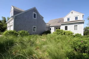
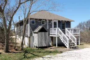
EASTHAM — Town meeting voters approved a bylaw change last spring that linked the allowed size of a proposed house to the size of contiguous uplands on the property rather than to its overall square footage. The purpose of the change was to preserve the character of Eastham by prohibiting massive homes on small lots.
Site plan review for a proposal to merge two coastal lots and demolish the existing houses on them to make room for a new 5,317-square-foot house overlooking Cape Cod Bay put the new bylaw to the test at a planning board hearing on Dec. 20.

The two properties are at 15 Sunset Lane and 40 Bay Shore Lane; both are owned by Craig and Lynne Perry, who live in Southbury, Conn.
The term “uplands” is broadly defined in the bylaw as land that excludes all wetlands, land under a water body, fresh or saltwater marsh, and areas subject to flooding at high tides. But the debate at the hearing revealed confusion over that last point: how to calculate the spot where high tide ends and dry land begins.
In fact, for most of the discussion the town’s community development coordinator, Philip Burt, and Bradford Malo, the Coastal Engineering Company’s project manager, who was there representing the Perrys, appeared to be the only people in the room who could follow it.
There are a handful of ways to determine the mean high-water line, from an unscientific “eyeball approach” to standardized methods developed by government agencies like the Dept. of Environmental Protection, the Army Corps of Engineers, and the National Oceanic and Atmospheric Administration.
Engineers generally base the location of the mean high-water line on an average of the tides over 19 years, according to Malo. Using that method, Malo had calculated the uplands area of the lot at 51,244 square feet, which put the proposed 5,317-square-foot house well within the allowed range. Any property with more than 50,000 square feet of uplands can support a house up to 6,000 square feet under the new bylaw.

Planning board chair Dan Coppelman asked Town Planner Paul Lagg how that uplands calculation matched up with the town’s bylaw.
That’s when the conversation became complicated.
Lagg said the new bylaw isn’t specific enough to tell. “It just says what is subject to flooding from high tides” can’t be counted as uplands, he said.
The aim of the bylaw is to link the size of a proposed house to the square footage of uplands on a property. But that’s not being achieved, Lagg said, “if I go out there and it’s under water.”
Burt said he went to the area in front of the Perrys’ lots during an astronomical high tide and saw water come up nearly to the base of the dune. Doing an on-the-spot rough calculation, Coppelman said that moving the high-tide line up to the edge of the dune would shrink the uplands calculation to 44,000 square feet.
Using that figure, the size of the house would have to be reduced. The house size can’t exceed 11 percent of the uplands total.
When Malo argued there were other regulatory definitions used by agencies like DEP, Coppelman replied, “It’s not your definition or anybody else’s definition; it’s the town of Eastham’s definition.”
Burt said NOAA’s calculation method for coastal Eastham is based on data from two points: Sesuit Harbor in Dennis and Provincetown Harbor. There is a way to calculate the mean high-water line and the mean “high high-water line” based on those points, he said.
The mean high is a line that the tide will go past about 50 percent of the time and fall below 50 percent of the time, Burt said. The “mean high high” is an average of the higher tides in the daily two-high-tide cycle.
“The contour line is about one foot west of the dune base, so we have to determine how much area that is,” Burt said.
Malo countered that he had already calculated the mean high high-tide line, basing it on a survey of the property. That line, he said, resulted in an uplands calculation of 50,810 square feet. By that method, the proposed size of the house would still be within the town’s standards.
The board gave the project site plan approval with some conditions. One of those was submitting a plan showing the mean high high-water line that would satisfy Lagg and Burt, since they are the board’s experts on the matter.
In a phone interview last week, Burt said he reviewed the plan with Malo following the Dec. 20 meeting. “Ultimately,” he said, “we go on their engineered plans.”
Both Burt and Lagg told the Independent they believe the town must tighten the wording regarding tide lines in the new bylaw to avoid debates like this one in the future.
Since the proposal calls for demolition of two existing houses, one of which is a bungalow built in 1948, a review will be required by the Eastham Historical Commission to determine whether the house is historically significant. If the commission decides that it would be preferable to preserve the house, it could delay demolition for up to 12 months under the town’s demolition delay bylaw.


