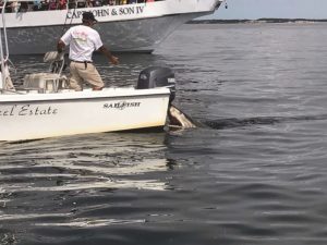
Striped bass have been steadily increasing in numbers and are starting to fan out from Race Point and show up in all the other usual spots — off Herring Cove and the Wood End Light and down by the cottages at Beach Point.
We haven’t seen or heard of any really big fish yet. Most of the fish caught so far seem to be between 25 and 33 inches. There do seem to be a good number of fish around, though. What is really encouraging is that, typically, as we get the stripers in our area, they start to thin out south of us in New Jersey and New York, but right now there are still a lot of fish down there as well. That is a good sign in terms of the overall size of this year’s mass.
Bluefish are still just to our south, occasionally showing up in the Canal and along the south shores facing Nantucket Sound, but they have not been seen in our waters as of this writing.
The seals are increasing in numbers by the day, and the first sighting of the season of a white shark preying on a seal occurred in Nantucket this past week.

This is a good time to remind everyone not to swim around seals or in areas where seals tend to congregate. Also try to avoid swimming alone, particularly at dawn and dusk, and take warnings of the presence of sharks seriously.
The Atlantic White Shark Conservancy and the Mass. Div. of Marine Fisheries are trying to develop a daily shark forecasting model. They have 10 years of tracking data based on tagged sharks and tracking buoys, and they want to use that database to try and develop a program to improve beach safety. What they propose is a forecasting system that would be a color-coded heat map to warn lifeguards when and where sharks might be present.
White sharks seem to do most of their predation in waters ranging from 49 to 68 degrees F. Using that water temperature factor, along with patterns of tracked visited areas by these predators, they feel they might come up with a tool that could be incorporated into the Sharktivity app already offered online. Sharktivity currently gives real time locations of all reported shark sightings.
Although I certainly feel it can’t hurt to have this additional tool in the toolbox, I’m not sure how accurate and dependable it could ever be. The water temperature range sharks apparently prefer for feeding is very broad. Our beaches fall in that range throughout most of the summer, and there are other factors that will undoubtedly affect the movements of white sharks along our coast.
Still, I am looking forward to seeing this model when it rolls out, and I’m hoping it is helpful as one more resource to reduce human encounters with sharks and increase beach safety for all. No word yet as to when this program will be ready.
In the meantime, it’s worth downloading Sharktivity as is. As I mentioned, it was developed by the AWSC and DMF, but a third partner has been the Cape Cod National Seashore. The app uses sightings by researchers and safety officials, but also crowd-sourced data, with public sightings verified by the New England Aquarium.
