WELLFLEET — To preserve eroding property and maintain beaches, thousands of cubic yards of so-called sacrificial sand is piled on coastal banks and bay shores here. It does not stay put. Local shellfishermen say finding new ways to fight erosion is urgent because the sand that has been piled along 36 waterfront properties from Indian Neck to Blackfish Creek is burying their oyster grants and smothering native grasses.
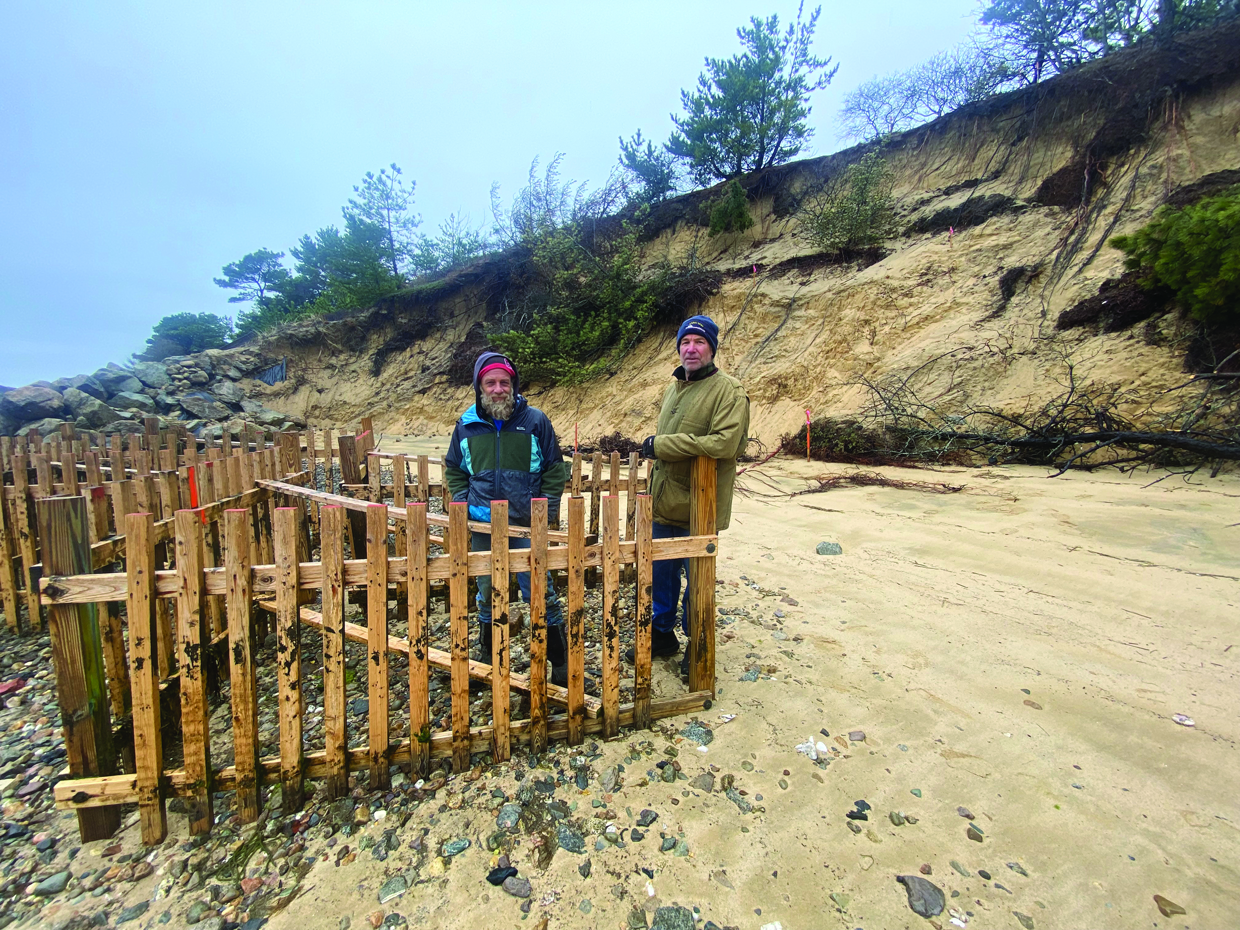
“We’ve watched them, year after year, bring truckload after truckload of non-native sand to fill this hole,” said shellfisherman Brad Morse, pointing to an eroding cliff off King Phillip Road. “With the next set of high tides, it’s gone.”
Morse, who has a shellfish grant near the tip of Field Point, and Kurt Graham, who has a neighboring grant, have been attending conservation commission and select board meetings to let leaders know that the “sand is ruinous.”
“My grant used to be a steamer grant before I got it,” Graham said. “You don’t see steamers down here anymore.” Graham has tried seeding both steamers and quahogs, but the sand “covers all the clams and kills everything,” he said.
Morse said he’s been trying to grow oysters on his grant since he got it in 2009, but “it’s almost impossible there,” he said. “They always get covered in sand and die over the winter.”
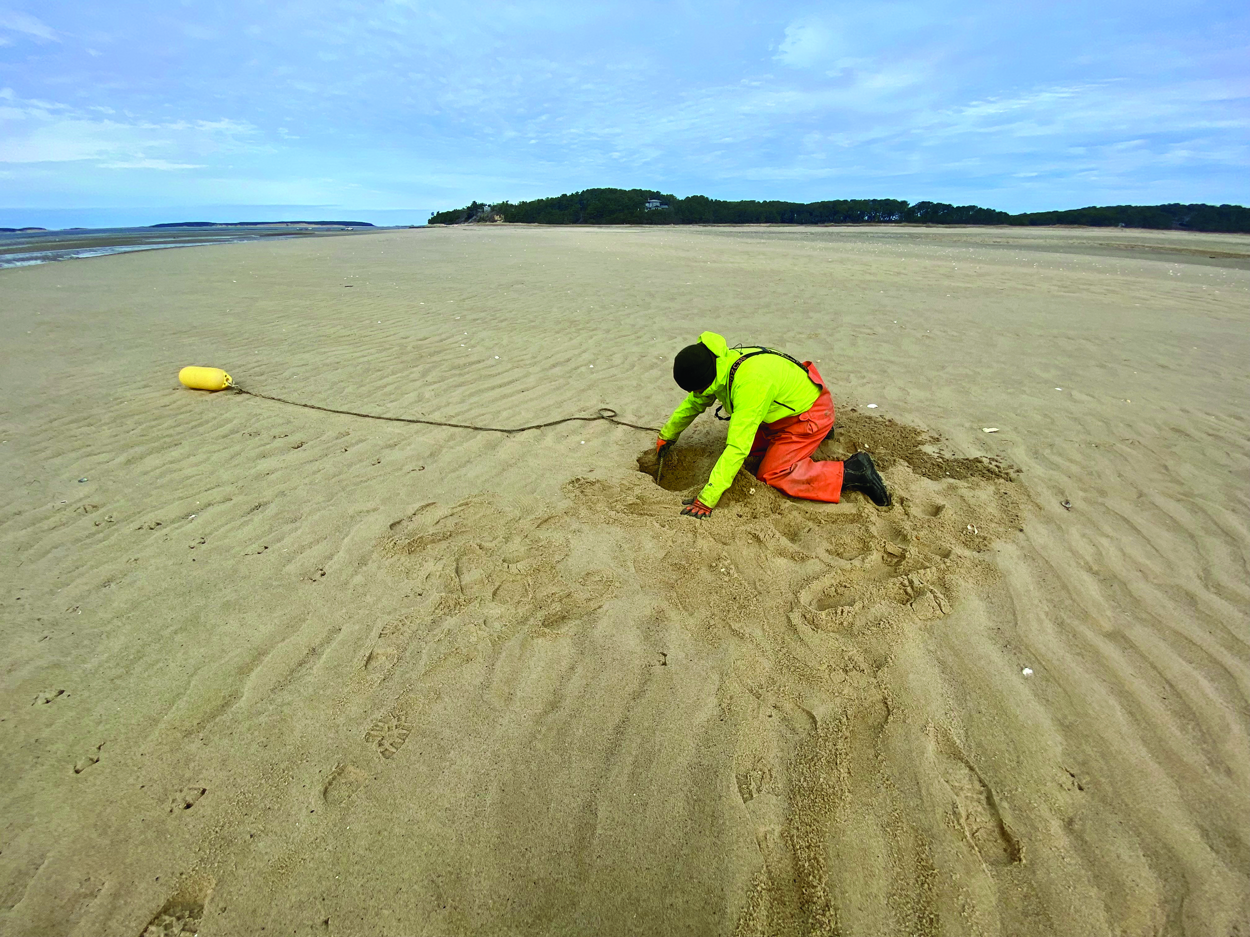
Select board member Michael DeVasto has a shellfish grant next to Morse’s. On a recent morning, DeVasto walked across an expanse of sand to reach a buoy he uses to mark the row of racks that hold the bags of oysters he is raising. Because of sand accumulation, the usable flats are farther from the shore than they used to be, he explained, as he dug down through a foot of sand to reach the pipe that anchors his buoy.
It Started With Revetments
The practice of dumping sacrificial sand is called “beach nourishment,” and it began as a response to problems posed by the construction of revetments — stone or concrete walls — meant to protect properties along the shore from erosion. Now, the sand — including 2,000 cubic yards dumped on the coastal bank at the Blasch house on Chequessett Neck Road in 2019 — is also being used in an attempt to prevent structures from collapsing over cliff edges.

By the 1970s, it was clear that revetments were altering natural sedimentation, leaving beaches with sand deficits and increased erosion and destroying habitats needed by piping plovers and diamondback terrapins, said Health and Conservation Agent Hillary Greenberg-Lemos.
That’s when scientists got together and worked with the state to come up with the Wetlands Protection Act, according to Barnstable County Coastal Process Specialist Greg Berman. “The idea was, if revetments continue, we’re not going to have beaches, dunes, marshes, and shellfishing areas,” he said.
The act barred the further construction of revetments. It also requires property owners who have old revetments to add sand to the surrounding banks according to an equation that, Greenberg-Lemos said, takes into account the height of the bank, the size of the revetment, and the erosion rate, which is difficult to calculate year to year.
The owners of each of the 36 properties along the Indian Neck to Blackfish Creek stretch of shore typically have to apply between 80 and several hundred cubic yards of sand each winter, theoretically replacing what has been lost because the natural sedimentation processes were interrupted by their revetments.
The theory isn’t proving to be correct, Berman explained, because sacrificial sand doesn’t have any vegetation or roots that might slow down erosion. It moves swiftly, and, in the Field Point area, for example, aided by existing revetments, it is pushed down to the end where DeVasto’s, Morse’s, and Graham’s grants are.
‘Catch-22’
The Wetlands Protection Act can be a fairly blunt tool, Berman said, “so we have to get a feel for how we can live with what’s being affected by these structures.”
“It’s a catch-22,” Morse said. “If they had never allowed walls, the sediment would be natural.” Morse and other shellfishermen argue that, in some places, including along the King Phillip Road properties, it would be better to allow the walls to be finished.
The problem is “tricky,” with competing stakeholders, Greenberg-Lemos said.

In her view, “Sand is the best solution because there’s no structure. It’s natural. It ebbs and flows.” But she sees its effects on both shellfishing and boating and agrees further evaluation of the problem is needed.
Gordon Peabody, director of Safe Harbor Environmental Services in Wellfleet, has volunteered to gather data that should help such an evaluation. He proposes to record the shifting elevations along the coast.
“It’s a tidal and storm-driven process,” Peabody said, adding that it’s important to know more about how the sand moves from one area to another. “It’s up to us to figure it out,” he said.
Meanwhile, the Wellfleet Conservation Commission is working “to try something new,” Greenberg-Lemos said, though possible alternatives are just starting to be explored.
One solution could be to try adding less sand and transition the King Phillip Road site to a salt marsh project, Greenberg-Lemos said. Another solution would be to take a more holistic view of where the required sand should be placed. “We’re trying to evaluate the best places to put the sand to benefit the system,” she said. “I hope to have more defined answers about that ongoing work soon.
“Coastal banks are going to continue to erode,” said the conservation agent. “The fishermen are going to have to figure out other ways to fish over time. Property owners are going to figure out what they’re going to do. We all need to get along to make it work.”


