WELLFLEET — The board of health unveiled new regulations on Aug. 27 aimed at reducing nitrogen levels in Wellfleet Harbor and its estuaries. These regulations mandate cesspool removal and will prompt upgrades to septic systems; they are part of the town’s targeted watershed management plan, created to bring the town into compliance with state regulations on nitrogen in the embayment.

If approved, the regulations will require that properties in the Wellfleet watershed and outside a planned sewer district get upgraded septic systems under certain conditions. Upgrades will be triggered by new or additional development on the property, an upgrade or relocation of a septic system, change in use of the property, transfer of ownership, or failure of a septic system. And since cesspools are classified as failed septic systems, this effectively means that cesspools in the watershed must be removed.
The board aims to adopt these new regulations at its Oct. 23 meeting, according to Health Agent Heith Martinez. Written comments on the rules will be accepted until Sept. 18, and in-person comments will be accepted at a public hearing on Sept. 25.
Septic Systems and Cesspools
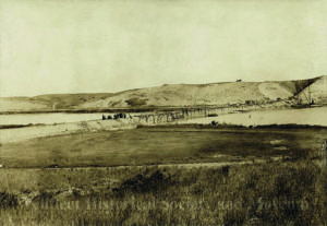
Currently, 176 pounds of nitrogen enters Wellfleet Harbor every day, according to a report by the Mass. Dept. of Environmental Protection, and 82 percent of it is from septic systems.
Excess nitrogen in the harbor system has led to harmful algal blooms, periods of low oxygen, reductions in seafloor animal populations, and loss of eelgrass, according to the report. The DEP report mentions that if nitrogen increases, it could trigger fish die-offs, algal blooms, destruction of seafloor animal communities, and “unpleasant odors and scum.”
The system was declared a “natural resource nitrogen sensitive area” in September 2023 by the DEP. In its report, the department found that Wellfleet Harbor’s nitrogen concentration was 0.665 mg/L. It would need to be lowered to 0.53 mg/L in order to restore the health of the system.
This designation gave the town two options: submit a notice of intent to file a watershed permit application, which would allow the town to implement its own plan for getting nitrogen levels down, or the state would mandate that all properties in the watershed upgrade their septic systems to the “best available nitrogen reducing technology” by September 2030.
The town chose the former and submitted a notice of intent on May 17. Town officials are now in the process of designing and implementing their targeted watershed management plan, which includes these new regulations as well as construction of a waste treatment facility at the transfer station and a sewer system in the town center. The sewer system will include properties around Main Street, Commercial Street, East Commercial Street, and Holbrook Avenue; houses along West Main Street and Pole Dike Road will be able to attach to it as well.
The town will also construct smaller treatment facilities for the Maurice’s Campground site and at Lawrence Hill to serve both new and existing houses in those areas as well as the nearby police and fire stations, for which the town received a $3-million MassWorks grant in fall 2023.
Striving for ‘Best Available’
According to Martinez, over 75 percent of Wellfleet properties lie within the watershed. But
the regulations apply only to those that fall outside the planned sewer district. Exemptions can also be sought due to a lack of available space on the property or demonstrated financial hardship without eligibility for assistance.
If a change is required and the property owner is not eligible for an exemption, the septic system installed must use “best available nitrogen reducing technology,” or BANRT, which means it emits less than 10 mg/L of nitrogen. That’s significantly less than statewide-standard Title V septic systems, which emit between 65 and 75 mg/L, according to Anastasia Rudenko, a water resources engineer with the engineering firm GHD, which helped design the town’s targeted watershed management plan.
Cesspools are a major target of these regulations. Technically, cesspools are already prohibited, said Martinez, but there is no program to remove them, nor does the town even know how many cesspools there are — thanks to a 1960 town hall fire in which many property records were lost, he said. So, Martinez and his team are beginning to inventory the town’s more than 4,000 properties and assess their septic systems.
Once that process is completed — Martinez thinks it will be done by the end of the year — they will begin notifying homeowners that they have two years to remove their cesspools before they start accruing fines. Martinez said the town modeled its strategy on the one Truro used to begin tackling its cesspool problem starting in 2021.
According to the town’s website, BANRT systems can cost as much as $42,500 for engineering, components, and installation. But there are several ways homeowners can offset those costs. The town is offering one-time $12,500 grants; Barnstable County’s AquiFund is offering zero- to 4-percent interest loans to offset septic upgrade or sewer connection costs; and the Martha’s Vineyard-based housing nonprofit The Resource Inc. is offering up to $50,000 in zero-interest forgivable loans. State tax credits are also available to offset costs, according to the board of health’s web page.
The new regulations will stay in place for 20 years or until nitrogen levels have been sufficiently lowered. Martinez said there will be a reassessment every five years and regular monitoring in between to see if healthier levels have been reached.