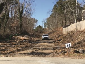
WELLFLEET — Alfred Kraft lives on a long, narrow driveway at the end of Old Chequessett Neck Road in Wellfleet. On either side of his property, expanses of National Seashore and conservation land are dense with pitch pine and scrub oak, some alive, some lying on the forest floor.
In recent years, Kraft has noticed a buildup of fallen trees in the understory around his house. He began to worry it could become tinder in a wildfire. “Then there were the fires in Maui,” he said.
This month Kraft called Josh Nigro, the Dept. of Conservation and Recreation (DCR) forest fire control warden for Barnstable, Dukes, and Nantucket counties. Nigro assessed Kraft’s home and made recommendations based on the landscaping and building materials, using the National Fire Protection Association’s Firewise Program.
Those recommendations include creating a “fire-free” area within five feet of a house using nonflammable landscaping materials like pebbles, as well as trimming and pruning large trees. Wood chips and mulch are ill advised, according to Nigro.
Fire-resistant roof materials including cement, stucco, plaster, and masonry are another important consideration, Nigro said. “The myth,” he said about fires, is that they are “this gigantic wall of flame that is coming out of the woods and burning homes down.” That’s not how it works. Fire is spread by embers, he said, which can travel up to two miles in front of a fire.
Much of the Outer Cape is at high risk for wildfire, according to the Barnstable County Wildfire Preparedness Plan developed by the county’s Cooperative Extension in 2012. That plan is the most recent blueprint for wildfire preparedness on the Outer Cape, but Nigro said that it is “still relevant and correct.” He added that the county is seeking funds to update the plan.
The Cape’s humidity, Nigro said, dampens the risk of a catastrophic fire. But according to the plan, of the Outer Cape’s four towns, Truro and Wellfleet are at the highest risk, with 66 percent of Truro at high risk and 64 percent of Wellfleet at high risk. Forty-one percent of Eastham is at high risk as is 20 percent of Provincetown. A small area near Wellfleet’s Old Wharf Point is at “extreme risk.”
Nigro, who worked on the plan, said many factors go into calculating risk. The biggest is potential fuel loading, or the amount of vegetation and dead brush on the forest floor that can catch fire. Weather patterns as well as topography are also factors, Nigro said. Those who live on higher ground are at greater risk because fire likes to climb.
William Patterson, a retired professor at UMass Amherst who has studied prescribed fires on Cape Cod, said that the Outer Cape has a “highly flammable landscape.” Many of the plant species on Cape Cod are prone to burning. Plants like huckleberry, scrub oak, and pitch pine all produce flammable resins in their leaves and stems that contribute to the spread of fire.
He also noted, however, that because the Outer Cape is so narrow “you could get a roaring fire and it wouldn’t burn any more than a mile or two. It would just reach the ocean.”
Nigro said that on average there are five brush fires per year on the Outer Cape, and those fires each burn only about a tenth of an acre.
Fire’s Benefits, Suppressed
David Crary, the retired fire management officer for the National Seashore, said that there haven’t been any fires of over five acres in at least 60 to 80 years. But samples of charcoal layers in sediment cores taken from Wellfleet and Truro ponds show that the Cape’s natural fire cycle included larger fires every 30 to 50 years before European settlement, Crary said.
“Fire is a natural part of the landscape,” he said. “There are species on the Cape that are dependent on fire.” Scrub oak, for example, “resprouts vigorously after fire,” said Patterson.
In the early 20th century, larger fires became less common as an increase in tourism and residential development led public opinion to favor fire suppression. “European-descended human beings have put a bunch of stuff in the way,” Crary said.
Fires were a common tool used by indigenous tribes on the Cape for land cultivation and agriculture, Patterson said. “I have devoted much of my career trying to learn a fraction of what the indigenous people knew about how to use fire,” he said.
Not only do fires “get things back on track ecosystem-wise,” Crary said, they control the buildup of fuel, like dead brush and pinecones, in the forest understory. He said that fire behaves like a vacuum cleaner, clearing dead brush to make way for new forests.
Our preference for fire suppression means that an accumulation of fuel heightens the risk of a more catastrophic fire. And “the longer you go, the more susceptible you are,” Crary said.
Crary, who worked for the Seashore for 33 years before retiring in 2021, facilitated prescribed burns where trained staff set tracts of Seashore land on fire to restore vegetation and reduce fire hazards. He estimated that he oversaw at least 400 prescribed burns between 1985 and 2021, most of which were smaller than three acres.
But since he retired, the Seashore has not hired a new fire management officer, and there have been no burns, Crary said. “It corresponds exactly with my retirement,” Crary said.
Wellfleet Fire Chief Richard Pauley said that Crary’s burn program “was very helpful” in mitigating the risk of wildfire. “But that hasn’t happened in years,” he said.
Pauley said that while his staff is well trained, he worries about the town’s access to much of the Seashore, which makes up 60 percent of Wellfleet’s total upland area.
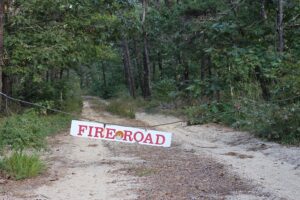
“We have fire roads that have not been maintained in well over 10 years,” Pauley said. “The width of the fire roads and the fact that they have not been brushed back so we can get down there is a big issue. The Seashore has not been proactive on that at all.”
Pauley said that the town does not have the resources to manage the many fire roads that snake throughout Wellfleet’s forests, “nor is it in our purview.”
Kraft also encountered obstacles attempting to clear the fuel load that has built up on his property. Because it is on a coastal bank abutting the Herring River estuary, he is required to get the conservation commission’s approval to remove trees, including dead ones.
“When I brought up the possibility of removing some of the dead trees lying on our land, conservation was not enthusiastic about it,” Kraft said. “They said that the dead trees were habitat.”
The removal of trees for mitigating wildfire risk came up at Wellfleet’s special town meeting on Sept. 18, when voters passed a bylaw amendment to allow the cutting of timber in the National Seashore as part of a Community Wildfire Protection Plan (CWPP).
The planning board unanimously voted against the amendment, arguing that Wellfleet currently does not have such a plan.
Pauley said the fire dept. will begin to develop a plan for the town this winter. But because many of the high-risk areas in Wellfleet are in the Seashore, the Park Service will have to cooperate.
The possibility of a larger fire on the Outer Cape “is a matter of time,” Pauley said. “I walk through the woods, I look around me, and I’m amazed we haven’t had something more significant yet.”
