Protecting the Outer Cape shoreline is a continuous project, so much so that “there is no end goal” to the work, said Rex McKinsey, Provincetown’s marine coordinator. “These are living places,” he added.

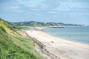
McKinsey is also project manager for the Inter-municipal Shoreline Management Program. And the group does have a near-term goal: to develop a cohesive approach to maintaining the outermost stretch of Cape Cod Bay shoreline. All four Outer Cape towns are involved.
“For the past two or three years the conservation agents have been meeting to collaborate,” said Provincetown Conservation Agent Tim Famulare. “We face the same issues. We’re all small populations in coastal communities. We’re trying to find a way to pool our resources.”
The program team consists of project manager McKinsey and the four town conservation agents: Hillary Greenberg-Lemos in Wellfleet, Emily Beebe in Truro, Shana Brogan in Eastham, and Famulare in Provincetown. Mark Borelli, Steve Mague, and Sam McFarland represent the Center for Coastal Studies.
The state’s Office of Coastal Zone Management (CZM) gave the program a $115,000 grant in 2019 for a first phase of work that was completed at the end of June. The team has now requested $248,470 from the CZM for phase two, and they’ll be asking the towns to contribute another $82,960, for a total budget of $331,430.
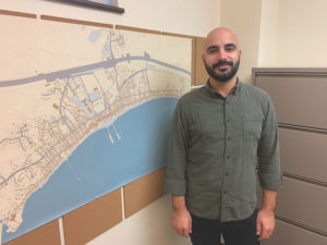
In the first phase, the group designed an Inter-municipal Shoreline Management Geodatabase (ISMG). The idea was that would serve as a baseline for identifying recommendations aimed at better coastal resiliency on the bay side.
The towns wrote a memorandum of agreement that emphasized taking “a science-based approach” to shoreline protection.
Shana Brogan explained that a geodatabase is a tool for evaluating resources, that is, “beaches, salt marshes, flood zones, and dunes,” she said, as well as human uses of the shoreline, “such as municipal dredging projects, beach sand nourishment, and revetments and seawalls.”
The IMSG plots both existing publicly available information as well as information from recent research at the Center for Coastal Studies. For someone like Brogan, who is working on protecting the coast in Eastham, it will provide a view of coastal processes in Eastham and beyond.
The group’s phase two proposal calls for adding more “layers” to this data. They should show locations of storm-tide pathways in Wellfleet and Eastham, as well as where there is potential for salt marsh migration.
Brogan said that salt marshes can withstand only a certain amount of wave action and saltwater submergence. As sea levels continue to rise, the geodatabase could help identify areas that might be suitable for establishing fringe salt marshes in response.
If all that sounds complicated, McKinsey said, the team would like to work on making the geodatabase accessible for everyone to view and understand.
Other components of phase two of the project include creating a regional sand bank system so that the four towns could get the sand they use to replenish shorelines from the same place. According to the geodatabase, the towns place at least 25,000 cubic yards of upland sand on the shoreline each year.
An inventory of low-lying roads — something Eastham has already started, through a partnership and with separate grant funding with Woods Hole Group — is another objective.
Then there’s the need for educating the public. Listening sessions and seminars for interested town staff, shorefront property owners, the general public, and middle school students are all part of the proposal.
These shoreline issues, Beebe said, “beg to be managed together.”
Brogan agreed. “Regardless of whether the funding comes through, we’re going to continue to work together and manage these things more consistently,” she said.
Big picture, the goal is to be ready for change. So that, “as things change,” Beebe said, “we can adjust and adapt.”


