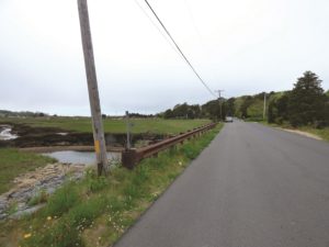
EASTHAM — There are 350 property owners who live along Bridge Road, Smith Lane, Samoset Road, and Dyer Prince Road in Eastham. Nearly 40 residents participated in a virtual public hearing on May 27 hosted by Shana Brogan of the town’s natural resources dept. and Adam Finkle of the Woods Hole Group (WHG) to discuss the low-lying roadway study recently conducted by the town’s consultants.
The study assessed the vulnerability of each of the four roadways to sea level rise and storm surge in the coming decades. The roadways were identified during the state’s municipal vulnerability preparedness program. Eastham received a $150,000 grant from the Mass. Office of Coastal Zone Management (CZM) last year to conduct the assessment in an effort to improve coastal resiliency.
Access to the 350 properties that abut the roadways could become restricted in the next few decades due to increased flooding if major improvements aren’t made, the study concluded.
“When I see the projections for what’s going to happen to Dyer Prence Road, I say to myself, ‘Well, I got another 20 years, maybe, in my house,’ ” said Nick Debs during the hearing. Dyer Prince Road leads to the Eastham side of Rock Harbor.

As reported in the May 28 Independent, WHG’s roadway assessment showed that the effects of sea level rise alone, not including storm or flood surges, would cause all four roads to experience daily inundation on some parts of the roadway from the marsh systems that sit beside them by 2050. By 2070, they would basically be underwater.
Finkle said that right now the most important thing is to maintain the existing infrastructure of the roads. This could be done by elevating the road; improving the marsh to help buffer effects of a storm; using fiber rolls, vegetated berms, or sloping rock revetments; and driving sheeting along the edge of the road to maintain that edge. Any of these approaches could be paired.
Prioritizing and vetting improvements to the roadways will be key. Some of the alternatives may not work for everyone.
“If Dyer Prince Road were raised four feet, for instance, I would not be able to get in my driveway,” Debs said. “There’s not enough slope.”
“We have to try to figure out if some of the solutions that we’re talking about may also have benefits for adjacent parcels or not,” Finkle said.
Safety is at a premium with this project, and that’s why Bridge Road may be of the highest priority, as it is the primary evacuation route other than Route 6.
“I think we came up with Bridge Road as our top priority because it involves so many people when trying to evacuate,” Police Chief Adam Bohannon said. “We’ve actually had a couple of situations where Bridge Road was blocked from flooding or other reasons, and so was Route 6, and the town was basically isolated.”
Nor’easters in January and March of 2018 took a toll on the Outer Cape and caused significant flooding along Bridge Road, Samoset Road, and other areas of Eastham.
“Those 2018 storms were very near exceeding that 100-year storm threshold,” Finkle said. “So, a one percent probability storm, except instead of them being 100 years apart, we had back-to-back storms in the same month that nearly exceeded that threshold.”
Fire Chief Kent Farrenkopf said his department had to evacuate someone from Samoset Road during one of the 2018 nor’easters. Since then, the department obtained a high-water rescue truck that can better serve in such situations.
The fire dept. considers a road impassible for vehicles if there is six inches of water on the road and impassable for an emergency vehicle if there is 18 inches of water on the road.
“We’re trying to adapt to the issues as we go along, by getting a vehicle that will help us get in there,” the chief said. But if flooding were to exceed that height, not even the rescue truck would be able to get past.
The town will ultimately have to identify what it can afford. Finkle said the plan is to apply for a second round of state funding to pursue design alternatives.
“The hope is that the next round of funding allows us to vet the design and create an engineering plan from that,” he said.
“We need to evaluate what the costs would be,” said Brogan. “It could be extremely expensive.”
The town will hold another virtual public hearing on this topic on a date in late June still to be set. Then Finkle and town officials will develop the preliminary design alternatives to prevent future flooding at two sites along one or two of the four roadways included in the study.
Feedback at the next public hearing will help determine where those two sites will be.
