So much smoke. Some welcome rain. Tropical storms. The “dog days of summer” on the Outer Cape may be numbered, but they’re offering plenty of things to consider.
As the sun rose through the eastern sky on Tuesday morning, instead of having its usual solar-white glow it was once again a deep-orange orb — a sure sign of more smoke-filled skies.
One of the hallmarks of summer weather forecasting nowadays is the tracking of smoke through the atmosphere. Massive wildfires burning over central and western parts of Canada, now a seemingly annual occurrence, pour thick smoke deep into the atmosphere where it’s captured by the jet stream and sent swirling south and eastward, transiting thousands of miles through the skies and sometimes wreaking havoc with weather forecasts.
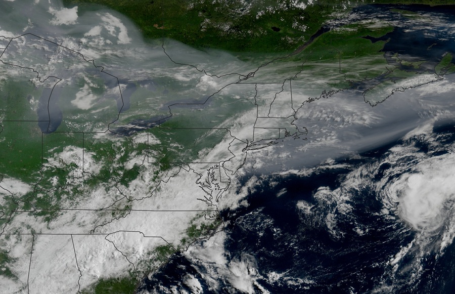
At best, the downstream result is a dull, milky sky. At its worst, air quality becomes poor — even harmful to those with asthma and other lung and heart issues — and a smell like campfire smoke or even burning plastic will develop. In this case, what looked to be a stretch of plentiful sunshine and deep blue skies is instead now a period of hazy skies and muted sunlight. You can thank climate change.
Last week, this column discussed the potential for some meaningful rainfall locally and the likelihood of downpours and flooding over parts of the mid-Atlantic and southern New England. Ultimately, two to four inches of rain fell from central Massachusetts southwestward to New York and New Jersey — with 6.5 inches falling in Queens, N.Y. Numerous flash flood warnings were issued, and once again social media was flooded with images of submerged cars, inundated subways, and impassable roads.
Here on the Cape, we saw a general half inch to one inch of rain, with around a half inch on the Outer Cape. It’s been a rather dry stretch, so the rain was welcome and gave us a short reprieve from watering our gardens and deck plants.
Speaking of wet weather — the 2025 Atlantic hurricane season is starting to ramp up. Tropical Storm Dexter formed early this week in the western Atlantic Ocean (with no land impacts anticipated), and there are additional tropical waves to monitor. In fact, several of our longer-term weather models show tropical systems taking shape over the next two weeks and trudging westward across the Atlantic. While nothing is of imminent concern, we should always pay attention as systems pass the Leeward Islands and head into the southwest Atlantic. It can take just a day or two for a storm to reach New England from the Bahamas.