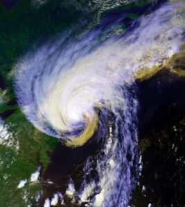
Spring in winter and winter in spring. That’s what this crazy year has brought us so far, along with copious amounts of rain. The more unpredictable the weather seems, the more tempting it is for some of us to try to guess what’s ahead for summer.
Fortunately for those of us with the itch, weather and climate scientists are starting to come out with their prognostications for tropical storms this season. NOAA won’t issue its forecast until May 23, but on April 4 researchers at Colorado State University’s Tropical Meteorological Project issued their annual report on the hurricane season ahead, which officially runs June 1 through Nov. 30.
A lot of what they’re looking at is the ENSO, or El Niño-Southern Oscillation. ENSO is a global climate pattern linked to yearslong ocean temperature trends in the tropical Pacific. During an El Niño period, warmer waters influence prevailing easterly winds around the equator to weaken or shift. In a La Niña period, below-average sea surface temperatures strengthen those easterly winds.

As the current El Niño retreats, and with the odds of a La Niña appearing to be at around 60 percent, according to NOAA’s current calculations, plus a generally warmer Atlantic, the Colorado State researchers are predicting 23 named storms this year, and they’re estimating 11 of those will become hurricanes. Those are the highest estimates CSU has ever made in its April forecasts. (They’ve been making Atlantic hurricane predictions since 1984; the highest previous April prediction was for nine hurricanes in 1995.)
Surface water temperatures in the Caribbean are already above normal, so things are looking rather ominous for now, although the CSU report reminds us the April outlook is less reliable than later ones. Considerable changes can happen in the atmosphere and ocean between April and the peak of the season.
In my mind, there’s a kind of probability game at play: I believe that having had a few very close calls with tropical storms in the past two summers, with big storms passing just east of us, this might be the summer our luck runs out. Maybe we won’t get hit with a full-fledged hurricane, but I’m thinking we’ll at least get a strong tropical storm.
Meanwhile, the slow arrival of spring continues to have the striped bass migration stalled. Last year at this time, our waters were in the low 50s here. Right now, you have to go all the way to Delaware to find ocean water temperatures in the 50s. North of that, we’re still in the low- to mid-40s. The bass are not feeling the need to move any farther north, although pogies are finally starting to show along the beaches of New Jersey and New York, which will help these bass get into a feeding mood.
The weather on the Cape has been so inhospitable lately for sport fishing it wouldn’t matter if they were here anyway. Most Outer Cape charter and party fishing boats are targeting mid to late May to begin making trips, so there is still plenty of time for things to get going.
Look for the bass to show up first around the Vineyard and the south shore of the Cape, then around the canal before we see them here.
When they do arrive, they will be feeding on mackerel and herring, so it is best to duplicate that in your offerings. Fresh mackerel, either whole or chunks, is the best bait — or fresh herring. We made an underwater video of our lines to see how these baits are handled by feeding bass, and one thing we saw is that they often will bump a whole mackerel and play with it like a cat will play with a mouse. But with smaller chunks of mackerel, they either ignored the bait or swallowed it whole, aggressively.
If you want to use artificial lures to catch bass, “matching the hatch” would mean casting swimming plugs that look like mackerel — like an SP Swimmer or a Bomber Long A. If you prefer to go with chrome jigs, the Crippled Herring is my early season favorite as well as the timeless Ava Diamond A-47 jig with a green tail.


