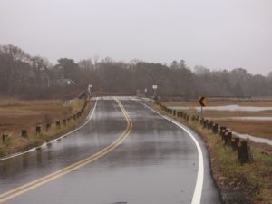
EASTHAM — In a few decades, some of Eastham’s most used roads could be underwater.
The town, in coordination with environmental consultants from the Woods Hole Group (WHG), has studied its vulnerable low-lying roadways, including four identified during the state’s municipal vulnerability preparedness program: Bridge Road, Smith Lane, Samoset Road, and Dyer Prince Road. During storm surges, these roads have been inundated and become impassable.
The town received a $150,000 grant from the Mass. Office of Coastal Zone Management last year to conduct an assessment and improve coastal resilience of its low-lying roadways.
“This is a really important first step,” said Conservation Agent Shana Brogan. “It’s important to do this thoughtfully and strategically.”

WHG first put gauges in marsh systems along these roads to better understand the tides. The group studied the existing conditions of the roadways; identified assets, utilities, municipal resources, owners, and abutters; and used town-wide and site-specific inundation maps and figures to gauge sea level rise and flood or storm surge probabilities.
“Quite a bit of data collection went into this whole process,” said Adam Finkle of WHG.
When considering only sea level rise and not including storm or flood surges, WHG determined that by 2050, all four roads would experience daily inundation on some parts of the roadway from the marsh systems near them. By 2070, they would basically be underwater.
The group also used data modeling to determine the probability of flooding during a given year.
“What makes this type of modeling unique is you can focus on very specific points along the roadway,” Finkle said.
The town’s fire dept. considers a road impassible for regular vehicles if there is six or more inches of water on the road and impassable for an emergency vehicle if there is 18 or more inches of water on the road.
Now that the study is complete, the town must decide the best method to move forward.
The first step is to maintain the existing infrastructure of the roads. Design alternatives could include elevating the road, improving the marsh to help buffer the effects of a storm, fiber rolls, vegetated berms, sloping rock revetments, and driving sheeting along the edge of the road to maintain that edge. Finkle said any of these alternatives could be paired.
The town will have to evaluate its budget and risk tolerance in determining solutions as well.
These ideas were scheduled to be discussed at a virtual public hearing hosted by the project team via Zoom on May 27.
Brogan said that, after that meeting, the team would present public feedback and imagery from the assessment to the select board.
Working with abutters along the roadways, including 350 property owners, will be key, and the fact of the hearing being virtual might help.
“A lot of these property owners don’t live here year-round,” Brogan said. “Normally they wouldn’t be able to make it to these meetings.”


